TL;DR

Get garden gear delivered free with Prime
- Fast, free delivery on millions of items
- Prime Video, Amazon Music and more included
- Member-only deals all year
Metro Phoenix has no single dependable first frost date: sheltered urban yards may avoid frost in some winters, while higher, open, or low-lying sites can frost earlier. Watch your local forecast, map cold pockets in your yard with a min/max thermometer, and protect sensitive plants before a cold night.
A Phoenix garden can stay green while a yard a few miles away wakes to silvered leaves. Metro Phoenix has no single dependable first frost date; a sheltered central yard, an exposed edge-of-Valley bed, and a low spot beside a wash can have very different nights.
That difference matters when you decide whether to leave a basil pot outside, cover a young citrus tree, or plant tender vegetables. You’ll learn what creates frost around the Valley, which local settings tend to run colder or warmer, and how to build a useful frost plan from your own yard’s readings. A calendar estimate is a starting point. Your plants’ height above the ground and the cold air settling around them can tell a more useful story.
Metro Phoenix has no single dependable first frost date; local terrain and exposure change risk.
Higher, open, and low-lying locations tend to run colder than sheltered, dense urban neighborhoods.
Cold air can pool in low spots, while walls and pavement can release stored heat overnight.
A min/max thermometer near plant height can reveal how your yard differs from a nearby station.
Protect sensitive plants before a forecast cold night, and remove covers after temperatures rise.
Valley Garden Field Guide · Winter Readiness
First Frost Dates Around Metro Phoenix: Microclimate by Microclimate
There is no dependable first frost date for the whole Valley. A sheltered urban yard may avoid frost in some winters, while a higher, open, or low-lying garden can chill earlier. Your yard’s readings are the most useful local forecast.
01 / Why dates differ
One city, many kinds of winter night
On clear, calm nights, the ground loses heat and chills the air near it. Cold air drains downhill and collects in low places. Meanwhile, buildings and pavement release stored daytime heat after sunset. A regional calendar estimate can’t capture all of those yard-level effects.
Cold air · pooling
Low spots gather chill
Washes, basins, and hollows can be colder than a nearby slope because dense cold air settles there, like water in a low corner.
Urban warmth · stored heat
Walls and pavement release warmth
Dense blocks, roads, and masonry can soften overnight cooling. A warm pocket helps, but it does not make a garden frost-proof.
Plant risk · surface cooling
Leaves can chill before the air
Exposed plant surfaces may frost when an official air reading is slightly above 32°F. Tender plants can also suffer cold damage before ice appears.
02 / Microclimate map
Where frost risk tends to rise
These are broad patterns, not promised dates. Elevation, open sky, wind, nearby pavement, and the shape of the land can change the picture within the same neighborhood.
| Setting | Typical pattern | Check in your garden |
|---|---|---|
| Central Phoenix and dense neighborhoods | Often warmer; sheltered sites may avoid frost in some winters. | Open rooftops, exposed beds, and distance from walls or pavement. |
| Older, established suburbs | Walls, trees, and paved areas can create warm pockets; open lots may run colder. | Whether plants sit beside a building or in an exposed lawn. |
| Outer suburbs and Valley edges | More open exposure and less built-up heat can raise risk. | Elevation, wind exposure, and distance from dense development. |
| Washes, basins, and low spots | Cold air can pool below nearby slopes. | Where water would collect if it flowed across the yard. |
| Foothills and higher terrain | Generally colder than the Valley floor; exposure shifts local risk. | Elevation, shelter, and how much open sky surrounds the site. |
Warm pocket example
A citrus tree beside a sun-warmed wall in an established neighborhood may fare better than plants in an open lawn nearby.
Cold pocket example
A low garden near a wash can frost before a slightly higher bed, even when both share the same neighborhood forecast.
03 / Make your own map
Find the cold pocket before it harms plants
A simple min/max thermometer placed near plant height can show how your garden differs from a nearby airport or official station. Compare locations over several clear, calm nights; one reading alone can mislead.
Pick two or three spots
Try a low bed, your usual growing area, and a sheltered wall or patio corner.
Measure near plant height
Readings at chest height miss the conditions around seedlings and low leaves.
Log cold-night lows
Record forecast and minimum readings after clear, calm nights to spot repeat patterns.
Place tender plants wisely
Keep vulnerable containers out of known cold pockets and favor a protected spot.
Example: If an open vegetable bed reads 34°F while a sheltered patio corner reads 38°F on two cold nights, that repeat difference can help guide where to keep a potted pepper. Recheck as wind, cloud cover, and cold-air flow change.
04 / Cold-night plan
Protect plants before temperatures fall
Use your local forecast alongside your yard’s past readings. Plant tolerance varies: a leafy annual, citrus tree, and desert-adapted shrub do not share the same cold limit.
Before sunset
Cover tender growth
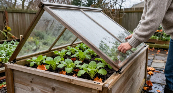
On a forecast cold night, cover sensitive vegetables before temperatures drop. Let the cover reach the ground and keep it off foliage where possible.
Move containers
Use a sheltered location
Pots cool quickly. Move vulnerable containers beside a protected wall or indoors when a freeze is expected.
After temperatures rise
Uncover plants
Remove covers the next day when temperatures rise so plants receive light and air. Keep watching local forecasts through the cool season.
A first frost does not predict the last
A warm spell does not end the risk. Year-to-year variation is large, and occasional hard freezes remain possible even as long-term warming changes freeze patterns.
Forecasts are local tools
For a specific season, check current National Weather Service forecasts and local station records. Treat regional estimates as a starting point, not a guarantee.
Why one Phoenix frost date can mislead your garden
First frost dates around Metro Phoenix vary by neighborhood and yard, so a citywide date can’t tell you exactly when your plants will face cold. Dense urban blocks often hold more overnight warmth, while open, elevated, or low-lying sites can cool faster. Even two gardens on the same street may differ if one sits beside a warm wall and the other lies in a hollow.
On a clear, calm night, the ground sheds heat into the sky and chills the thin layer of air near it. Cold air also moves downhill and settles in depressions. Think of it like water poured across a tilted patio: it gathers at the lowest point. A raised bed on a gentle slope may escape damage while a nearby basin catches the cold.
“Frost date” can mean different things, too. A forecast air temperature of 32°F marks freezing air, but frost forms when a surface cools enough for ice to develop. Exposed leaves can frost when a thermometer reads slightly above freezing, while tender plants can suffer cold damage before ice appears. If your basil wilts after a chilly night, the plant’s tolerance may have been the limit—not a visible blanket of frost.
Popular right now

Ninja Foodi Air Fryer, 8 Qt DualZone, 6-in-1, Grey, DZ201

Breville BES870BTR Barista Express Espresso Machine, Black Truffle

Bose QuietComfort True Wireless Earbuds with Active Noise Cancellation, Black
As an affiliate, we earn on qualifying purchases.
How pavement and walls can make one yard warmer
Buildings, roads, and pavement store heat during the day and release some of it after sunset, which can give dense neighborhoods a warmer overnight setting than nearby open ground. This urban heat-island effect helps explain why central Phoenix often sees less frost than exposed desert or rural edges. The warmth is local, though; it doesn’t guarantee a frost-free garden.
Picture two winter vegetable beds after a sunny December afternoon. One sits beside a south-facing block wall and a paved walk; the other rests in an open lawn, far from buildings. The wall and paving may soften the first bed’s nighttime chill. The open bed loses heat more freely to the clear sky, and its leaves may cool faster.
Warm pockets have limits. A rooftop planter or an exposed yard can lose heat quickly despite its urban address, and cold-sensitive plants may still need protection. A wall also casts shade during the day, which can mean less stored warmth by evening. Look at the whole setting: sun exposure, surrounding materials, wind, and nearby low spots. If your potted pepper sits on a balcony, moving it beside a protected wall before a cold night may matter more than the neighborhood name on a weather app.
Which Metro Phoenix locations tend to frost first
Higher, open, and low-lying locations generally face more frost risk than sheltered, densely built parts of central Phoenix. These are broad patterns, not promised dates. Elevation, local terrain, wind exposure, and nearby pavement can shift the result from one garden to the next.
| Setting | Typical frost pattern | What to check in your garden |
|---|---|---|
| Central Phoenix and dense neighborhoods | Often among the warmer Valley settings; frost can still affect open or rooftop sites. | Exposure above rooftops and distance from walls or pavement. |
| Older, established suburbs | Walls, trees, and paved areas can create warm pockets; open lots may run colder. | Whether plants sit near a building or in an exposed lawn. |
| Outer suburbs and Valley edges | More open exposure and less built-up heat can raise risk. | Elevation, wind, and distance from dense development. |
| Washes, basins, and other low spots | Cold air can pool and chill plants below nearby slopes. | Where water would collect if it flowed across the yard. |
| Foothills and higher terrain | Generally colder than the Valley floor; exposure changes local risk. | Elevation and whether the site faces open sky or has shelter. |
For example, an established neighborhood with mature trees and a warm wall may shelter a citrus tree, while an open bed on the Valley edge gets a colder night. A lower garden near a wash can also frost before a slightly higher bed nearby. Use the table as a map of clues, then check your own minimum temperatures over several cold nights.
How to spot a frost pocket before it harms plants
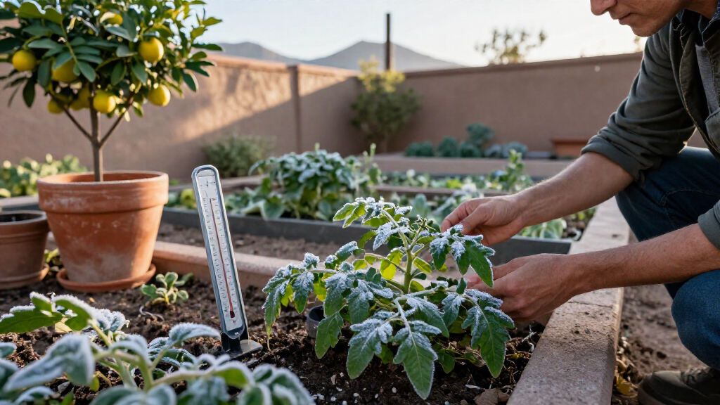
You can identify a frost pocket by comparing overnight minimum temperatures in different parts of your yard. A simple min/max thermometer near plant height records the cold your garden experiences, which may differ from the reading at a nearby airport. Take several readings through the cool season; a single night can be misleading.
- Choose two or three spots. Place one thermometer near a low bed or wash-facing corner, one in your usual growing area, and one near a wall or other sheltered spot.
- Set each sensor near plant height. A reading at chest height won’t show the conditions around low leaves and seedlings.
- Compare readings after clear, calm nights. Note where the lowest temperatures repeat, and record the forecast alongside them.
- Use the pattern to place sensitive plants. Keep vulnerable containers away from a low pocket; give cold-sensitive plants a protected spot with appropriate sun.
Say your open vegetable bed reads 34°F while the sheltered patio corner reads 38°F on two cold nights. That four-degree difference is useful evidence when you choose where to keep a potted pepper or set out a frost-tender transplant. Don’t treat one reading as a lifetime rule, though: wind, cloud cover, and the direction of a cold-air flow can change from night to night.
What to do when a cold night enters the forecast
Protect a sensitive plant before sunset when a cold night is forecast for your location; don’t wait for morning frost to confirm the risk. The right response depends on the plant and how cold the air will get. A leafy annual, a citrus tree, and a desert-adapted shrub don’t share the same cold tolerance.
For an example, if your forecast calls for a near-freezing night and your yard often runs colder than the reported station, cover tender vegetables before temperatures fall. Use a cover that reaches the ground and keep it off foliage where possible. Remove it after temperatures rise the next day so the plant can receive light and air. Move containers against a protected wall or indoors when practical; pots cool faster than surrounding soil.
Use these clues when planning protection:
- Check the local forecast and plant tolerance. A warm afternoon doesn’t settle what will happen overnight.
- Cover before sunset. A cover already in place can hold some warmth escaping from the ground.
- Mind the container. Small pots can chill quickly; shift them to a sheltered location.
- Uncover after the cold passes. Leaving a cover on through a sunny day can trap heat.
Cold protection lowers risk, but it can’t turn a tender plant into a hardy one. If a freeze is coming, prioritize the plants that matter most and use your own yard readings to guide placement.
Why an early frost doesn’t predict the rest of winter
An early first frost date does not reliably predict the last frost date or the rest of the winter. Metro Phoenix can have a cold snap, a stretch of mild weather, and another freeze later. A warm spell is pleasant, but it doesn’t close the door on cold nights.
Long-term warming can reduce freeze frequency or shift timing, yet occasional hard freezes still happen. Year-to-year variation remains large, so a general climate trend can’t promise a safe planting date for one particular season. When you plan a tender planting, use the current National Weather Service forecast and local station records for that season, then adjust for your garden’s colder or warmer pockets.
Consider a gardener who sees an early frost in an exposed corner and assumes a colder-than-usual winter is coming. That one night gives useful information about the corner, but it doesn’t forecast the next cold event. Another gardener who sees no frost by midwinter shouldn’t assume the risk has ended. Keep tender plants protected according to the forecast and their cold tolerance, and let repeated yard readings improve your decisions over time.
Frost, freeze, and cold damage call for different responses
Frost means ice has formed on surfaces; a freeze means air temperature has reached 32°F or lower. They often overlap, but they aren’t interchangeable, and neither label alone tells you whether a plant will be hurt. The plant’s tolerance and the length of exposure matter.
A forecast of 33°F or 34°F doesn’t rule out frost in your garden. The forecast represents a location and measurement setup, while a leaf or exposed surface can cool below the surrounding air. Your yard might also be colder than the station, especially in a low spot or open area. If your sensitive plants sit in a known cold pocket, treat a borderline forecast with care.
For instance, a hardy shrub may shrug off a brief frosty morning while a tender basil plant droops after a night that never produces visible ice. A frost covers the surface; cold injury describes what the plant experiences. When you notice limp leaves the next day, don’t diagnose from the word “frost” alone. Compare the minimum reading, the plant’s known tolerance, and how long the cold lasted. That gives you a better basis for protecting the rest of the bed next time.
Frequently Asked Questions
When is the first frost in Phoenix?
There is no one first frost date for all of Phoenix. Sheltered urban yards may avoid frost in some winters, while higher, open, or low-lying sites can frost earlier. Check your local forecast and your own garden readings.
Does Phoenix get frost every year?
Frost is possible, but local risk varies. Some sheltered urban gardens may go years without a damaging frost, while exposed sites can see colder conditions. Your elevation, yard layout, and plant exposure all matter.
Can frost form when the forecast says 33°F or 34°F?
Yes. Exposed surfaces can cool below the measured air temperature, and your yard may run colder than the forecast location. Protect sensitive plants if your garden is a known cold pocket.
Which parts of Metro Phoenix are most at risk?
Higher terrain, open areas, Valley edges, and low spots tend to be more vulnerable than sheltered, densely built central neighborhoods. Cold air can collect in a basin even when a nearby slope stays warmer.
How can I tell whether my yard is a frost pocket?
Compare overnight minimum temperatures in several yard locations over multiple clear, calm nights. Put a min/max thermometer near plant height in a low area, an open bed, and a sheltered spot, then look for repeated differences.
Does an early first frost mean a colder winter?
No single early frost reliably predicts the rest of the winter. A cold snap can be followed by mild weather and later freezes. Keep watching current forecasts instead of treating one night as a seasonal forecast.
Conclusion
Use the forecast as a warning and your yard as the final guide. Compare temperatures in a low spot, an open bed, and a sheltered corner; then place and protect sensitive plants where your readings show they’ll fare best. First frost dates around Metro Phoenix describe a broad pattern, not a promise for your porch.
On a cold, clear night, the difference between a thriving plant and a limp one may be a few feet of elevation or a pot moved beside a warm wall. Let your thermometer show you where winter settles in.